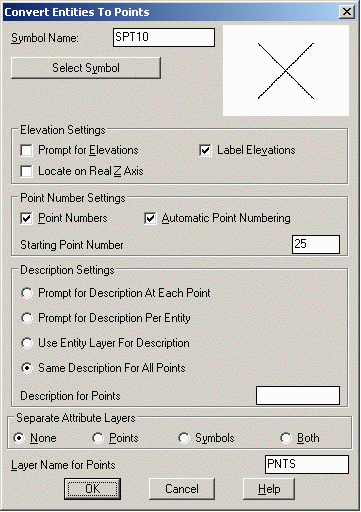
This command will create Carlson Survey points on selected entities.
The
points
are stored in the current coordinate (.CRD) file and drawn on the
screen. For arcs
and polylines with arc segments, points are created at the radius
points of the arcs as well as the PC and PT.
In the first options dialog, there are settings for the point attributes. To have points obtain their elevation from the selected entities, unselect the Prompt for Elevations toggle and select the Locate on Real Z Axis toggle. After you have specified the point options, a secondary dialog appears which allows you to specify the entity types to process. Under the Description Settings, Prompt for Description At Each Point will prompt you at the command line for a description for each individual point. Prompt Per Entity will ask you for a description per each highlighted entity. Use Entity Layer for Description will assign the layer name to the description. Same Description For All Points will prompt you for a single description for all points.
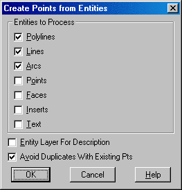
The second options dialog has processing settings. When Entity
Layer for Description is checked, the layer name of
the entity will be used as
the description for the created point. When Avoid Duplicates with
Existing Pts is checked, this
routine will not create a point if a
point with the same coordinates already exists in the current
coordinate (.CRD) file.
Create Points From Entities Dialogs Choose settings
Select arcs, faces, points, text,
lines and polylines.
Select objects: pick
entities
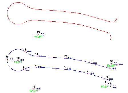
Before and after using Create Points from Entities. Points
are created at each endpoint and radius point.
Pulldown Menu Location: COGO
Keyboard Command: autopnts
Prerequisite: drawing entities