Calculate Residuals
Function
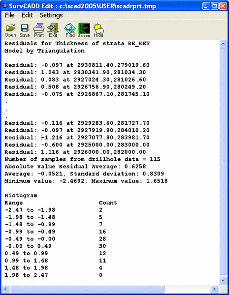
This command measures the accuracy of the strata grid model based on
the residual at each drillhole data
point. The residual is calculated by removing the data point and then
comparing the grid model
calculation at the point with the actual value. Residuals for any
strata data value such as thickness,
elevation or BTU can be calculated using any modeling method including
triangulation,
polynomial, Kriging, least squares and inverse distance.
Consider calculating residuals for thickness with five drillholes.
For each drillhole, the
drillhole is temporarily removed from the model and the thickness
calculated at the drillhole position.
For example, one drillhole could have a thickness of 5.0. When this
drillhole is removed and the
four remaining drillhole using inverse distance calculate the thickness
at this point, the
modeled value could be 5.25. The difference of 0.25 between the actual
value 5.0 and the modeled
value 5.25, is the residual.
The first dialog to appear contains some settings on the residual
analysis.
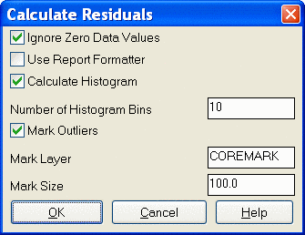
- Ignore Zero Data Values: This
will ignore any values of 0 that are found in the drillhole. They could
be thickness, elevation or any quality attributes. Sometimes they
should not be ignored, depending on what is being modeled.
- Use Report Formatter: Turn
this option on to see the report with the Report Formatter. If it is
off, then the standard report viewer is used.
- Calculate Histogram: The
Histogram is a statistical graph of the distribution of a dataset. It
shows the number of data samples within a series of value ranges.
- Number of Histogram Bins: The
user can set the number of bins for the graph. For example, if a
dataset of sulfur has values from 1.0 to 4.0 and the user asks for 3
bins, then the histogram will show the number of samples between 1.0 to
2.0, between 2.0 to 3.0 and between 3.0 to 4.0.
- Mark Outliers: The Mark
Outliers option highlights data points that are more than 2 standard
deviations from the data set average. This can be useful for flagging
possible problem data points.
- Mark Layer: This is the
AutoCAD layer of the circle mark drawn around the outlier drillholes.
- Mark Size: This is the
size of the mark, or circle drawn around the outlier drillholes.
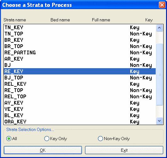
For triangulation and polynomial, the residual is not calculated for
some points
because removing these points shrinks the triangulation area and the
point may fall outside the area.
Also you need more than three points to calculate residuals with
triangulation and
polynomial methods.
Prompts
Select drillholes, channel samples and
strata polylines.
Select objects: Specify opposite
corner: 269 found
Select objects:
Reading drillhole 269
Choose modeling method
[<Triangulation>/Inverse dist/Kriging/Polynomial/LeastSq]? I
Use inverse distance to which power
[First/<Second>/Third/Other]?
Use elliptical inverse distance
[Yes/<No>]?
Calculating grid by inverse distances
4...
Try another modeling method (Yes/<No>)?
N
Calculate BOTTOM ELEVATION residuals for strata 9 (<Yes>/No)?
N
Pulldown Menu Location: StrataCalc in Advanced Mining
Keyboard Command: residuals
File Name: \lsp\makegrid.arx