Page 1 of 1
Spot elevation labels

Posted:
Wed Sep 21, 2011 7:10 pmby Pin Cushion
This is a two step process that needs to be one step. It is (A) a spot label with leader and (B) a donut. I would like very much to have this in one step.... and while I am asking for stuff, make me a button for it


Posted:
Wed Sep 21, 2011 8:53 pmby Dent Cermak
There are just so many ways that people show spot elevations that the programmers would have to work for months to cover them all.
For example, the way I was taught (in the Army) to show spot elevations was by having the decimal point of the elevation mark the spot where the shot was taken. This way there is only one element involved and there are no nasty leader lines. Simply insert your elevations as text and then move to the correct location. There IS a check box for doing that, but its "move' is not real accurate.
There are probably 100 other ways people do spot elevations, so meeting all needs would involve a very large chunk of programming time.

Posted:
Wed Sep 21, 2011 9:54 pmby Pin Cushion
It would not that complicated... it is simple really, all they would have to do is combine the leader and symbol pull downs labeling options... or add a check box for "add donut" to the label with leader option.
OTHERWISE I have a leader, and elevation, and nothing to mark the spots location.... just a leader and an elevation

Posted:
Wed Sep 21, 2011 11:18 pmby Dent Cermak
No, it would not be that difficult, but my point is that is the way YOU do it. It is not a standard practice across the country.
Should Carlson then have to make a button for all the other ways people display a spot shot?
This is the kind of thing that you need to find some computer programmer and pay him to create your custom routine for you. It's a bit unfair to expect Carlson to do it for you for free. Then they have to do the same for the next 27 people who have another way. They'd go bankrupt trying to please all of the people all of the time, a feat which we all know is impossible.

Posted:
Thu Sep 22, 2011 12:46 amby Pin Cushion
...Settle down Francis, I was joking about the button.
But not about combining the two labeling options. Why not combine the best of both worlds/tabs.
Would you also argue that Reese's should remove the peanut butter from the butter cup??

Posted:
Thu Sep 22, 2011 1:14 amby Dent Cermak
If there is an actual need, I am sure they will do it. I just don't see the need. You could do what you want with an attribute wblock or a block.

Posted:
Thu Sep 22, 2011 3:29 amby Pin Cushion
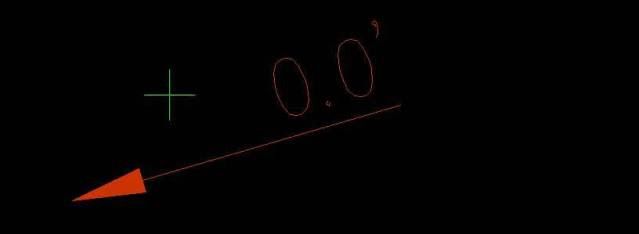
I found the arrow check box and I can settle for this... but I like my donut better

I think it is creating a point on the spot, is that a safe assumption? if so is it possible to do away with that?


Posted:
Thu Sep 22, 2011 12:39 pmby Dent Cermak
Yes. Set pdmode=0. That should do away with those little buggers.

Posted:
Thu Sep 22, 2011 12:52 pmby Pin Cushion
My PDmode is at <0>.... the node is super small on the end of the arrow and can only be selected in a window right.

Posted:
Wed Oct 12, 2011 5:23 pmby Nava Ran
Change the position of the attributes by opening and
editing any of the srvpno# drawings. Specify this attribute
layout id in the point defaults
http://screencast.com/t/xGH9EJUto
Spot Elevation by text and leader - convert to a point

Posted:
Wed Jan 11, 2012 4:38 pmby Sgarland
Is there a routine to take and engineer's spot elevation that is just text with a leader, and have the program read the text, and insert a point with that elevation at the end of the leader?
This would greatly speed up grading plan preperation for staking.
Re: Spot Elevation by text and leader - convert to a point

Posted:
Wed Jan 11, 2012 8:34 pmby gskelhorn
Sgarland wrote:Is there a routine to take and engineer's spot elevation that is just text with a leader, and have the program read the text, and insert a point with that elevation at the end of the leader?
Yes, it is command SPOTELV2. I have the Civil Suite so I can't tell if it is part of the Survey or Civil. This command is very flexible and useful.

Posted:
Thu Jan 12, 2012 4:24 pmby Nava Ran
Civil>3D Data Menu>Convert SpotElev to Points


