|
Remote Elevation
|
|
Remote Elevation
|
This command allows you to observe a point that cannot be reached vertically, such as a power line, building top, etc.. The routine uses two observations - one for the base point and one for the vertical angle to the target object. The routine then calculates the target point's elevation.
By placing the prism below or above the desired point, Carlson SurvCE stores information about the base point. Then you can take a second reading, observing only the zenith/vertical angle to the target object point. Using these two observations, SurvCE calculates the intersection of the extended zenith/vertical angle with a vertical line from the base point to determine the elevation. Reporting includes the elevation difference between the prism and the target object and the elevation of the target object.
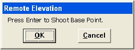
Steps to take a remote elevation reading are as follows:


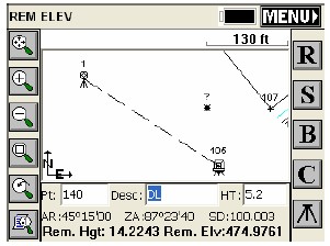
Back in the REM ELEV screen, your angle, zenith, and slope distance are shown along with the remote height and remote elevation. Press S to store this point.

Other right-side options include: