|
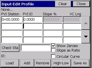
Input-Edit Profile
|
|
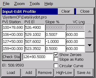
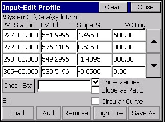
Input-Edit Profile
|
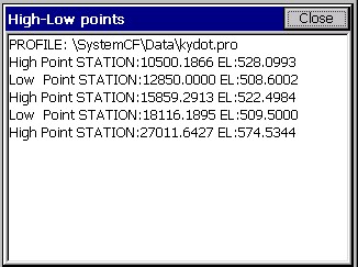
This routine allows field entry of vertical alignment files for roads, sewers and other types of alignments. Vertical alignments can also be loaded and edited. In addition, high and low points can be calculated and the elevations of individual stations can be calculated. Vertical alignments are stored as files with a .PRO extension. Vertical alignments are typically referred to as profiles. In Carlson SurvCE, the station ranges of the profile and centerline do not need to match. As long as they have station ranges in common, any profile can be used with any centerline for all advanced Roading commands, and for Surv menu routines such as Offset Stakeout and Elevation Difference by Road Design files.
Profile Entry
Profiles are extremely easy to enter. When the command is selected, if no prior profile has been entered, you will encounter the blank Input-Edit Profile dialog. You can also obtain a blank screen and start a new profile by tapping Clear.